Roadtrip: ruins + architecture

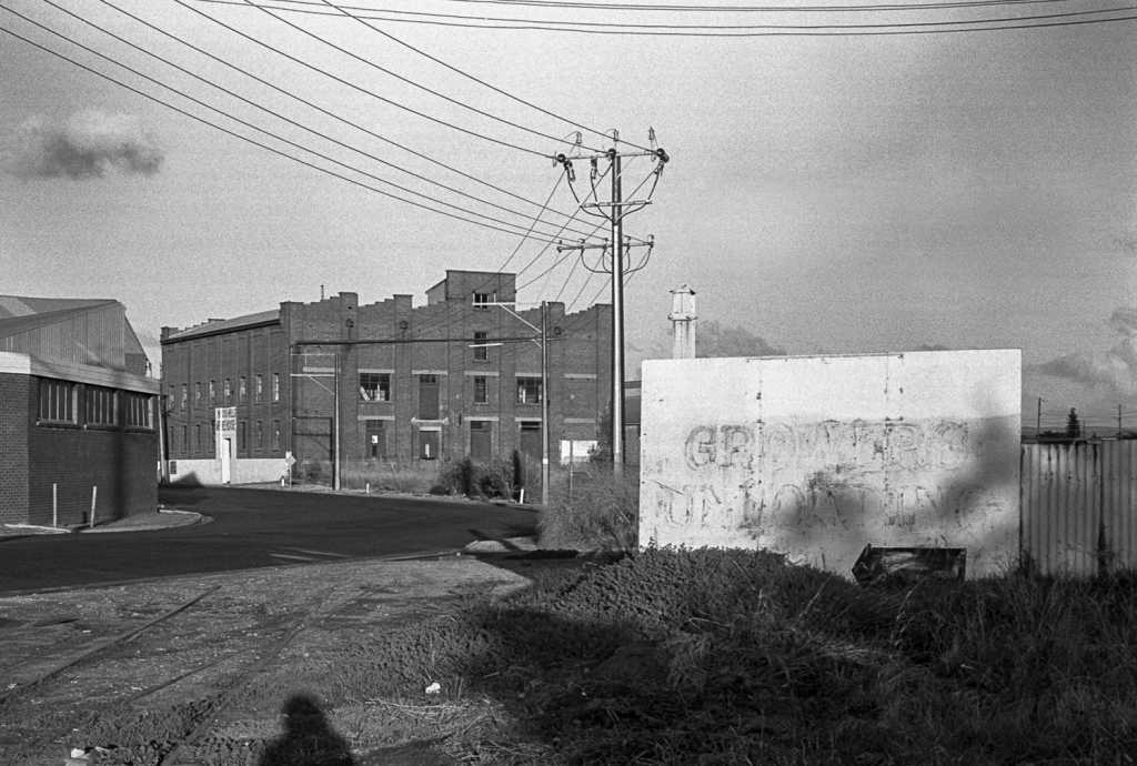
I recently dug out some photos in the b+w archives from some photo trips that I made between the eastern Mt Lofty Ranges and the Murray Plains in the 1980s. I started remembering these old road trips in this part of the mid-north of South Australia –eg., Sedan, Cambrai and the Marne River— when I briefly revisited the area in 2019 and then when I explored it more throughly in 2020 whilst I was at the Lavender Trail Kapunda camp.

These photos appear to be related to, or an extension of, this roadtrip. They were possibly made around the same time or more than likely, just after that roadtrip to the Mt Lofty Ranges. I cannot quite remember. From what I can recall these are photos made on a day trip from Adelaide, as I don’t remember sleeping in the Kombi overnight on the roadtrips in the eastern Mt Lofty Ranges.

Linhof Technika70
shearing shed, Dutton, Eudunda Rd

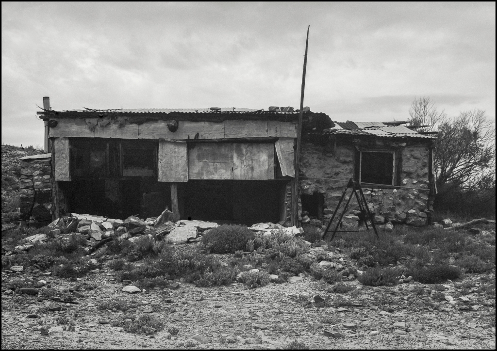
On the 1980s road trip I travelled along the Eudunda Rd, which runs parallel to the Mt Lofty Ranges between Truro and Eudunda through agricultural land. This area has a number of farm ruins which caught my eye. Ruins, including the old railway line to Cambrai and Sedan, are what initially stands out when travelling though this region for the first time.

wandering in Port Adelaide

I have scanned a few more archival images from those I made when I wandered around the urban part of the Port Adelaide precinct with a Leica in the late afternoon during winter. The Port had a gritty, grungy, industrial, working class character in the 1980s.

billboard, Port Adelaide

What drastically reduced the need for waterside labour at Port Adelaide’s inner harbour was the development of deep berths at Outer Harbour to accommodate larger ships, coupled with the introduction of bulk handling facilities and containerisation in the 1970s. The 1970s and 80s was also a period of general decline in raw material processing and manufacturing in the Port, with many mills, foundries and factories closing or relocating.

The result was that historic buildings were closed and even vandalized whilst shops in the main streets of the suburb were empty and boarded up. It was becoming a place of social and economic obsolescence, a derelict dockland – stagnant and lifeless.

Roadtrips: Andamooka

As noted in some of the earlier posts in this blog the third section of The Bowden Archives and Other Marginalia consists of the various road trips of different kinds that I made whilst I was living in Bowden, then Ovingham, and finally in the south-east corner of Adelaide.

The mini trips include those around the edge of Adelaide: those to the suburban beaches to escape the summer heat in Bowden; explorations around Port Adelaide; trips to the Mt Lofty Ranges, then to Victor Harbor (and Kangaroo Island). The longer roadtrips were to the South Australian Mallee and the mid-north, and those along the River Murray to Melbourne and the east coast of Australia.

The last road trip, which would close the third section, is the trip that I made in the 1990s to the opal mining town of Andamooka in the northern part of South Australia.

dugout, Andamooka, 1990s

A colour version of this picture of this shelter or dugout can be seen here on my ‘On the Road’ Tumblr blog. I made a couple of colour photos on this trip.

An update on the Bowden project

In this post in 2016 I mentioned that I had started to work on the Bowden Archives and Other Marginalia book. In two other posts in 2017 about the Adelaide Art Photographers 1970-2000 book, I indicated that a few of my archival non-Bowden photos would form a portfolio in the book. That book has now been published by Moon Arrow Press in Adelaide.

This leaves the Bowden Archives and Other Marginalia project to be completed as a book. It will have 3 sections. The first one is on street photography in Melbourne (circa 1977-9) after I’d finishing studying at the Photography Studies College and snapshots in Adelaide. The middle section will consist of the Bowden photographs. The third section includes photographs made on various road trips around and outside of Adelaide.

The picture below would be part of the third section, if it makes the cut:

Silo, Snowtown (?), South Australia, 1996

I have pulled the Bowden project from being published by Wakefield Press, who will now be publishing the Tasmanian Elegies project. The Bowden Archives and Other Marginalia book will be published by Moon Arrow Press in 2021.

Roadtrip: Eastern Mt Lofty Ranges

On my recent Mallee Routes photo trip I returned to sites in the eastern Mt Lofty Ranges that I had briefly photographed in  during the 1980s.   I spent a bit of the on the road time walking around the area on the Tungkillo  to Palmer  section of the Randall Rd, which runs from Mt Pleasant to Walker Flat.

Whilst I was taking some scoping snaps with my digital camera I remembered some of the photos that I’d made in the 1980s in this general location. The image below is one of the images that I remembered making using a Linhof Technika 70:

Eastern Mt Lofty Ranges

I recalled that in the 1980s I was visually attracted by the bareness of this landscape. It was a stripped, overgrazed landscape with just the odd tree hanging on. There was very little in the way of replanting or Landcare.

Continue reading

topographics

In a previous post on this archival blog I  had mentioned my shift from street photography to topographics during the 1980s. This shift  emerged whilst  I was photographing around Osborne, Gillman  and Outer Harbor  along the Port River estuary on the Le Fevre Peninsula.

This is an example of my  topographic approach to industrial type urbanscapes—a wasteland, if you like– that was made  in the 1980s:

Osborne, South Australia

Another version of the topographical approach to this wasteland or ravaged landscape  that was made in the same photo-session is here.

The shift from street photography to topographics is how I have structured  my portfolio in  the Adelaide Photography 1970-2000 book, which  is to  be published by Moon Arrow Press in 2019.  It is part of the independent photobook  movement.  Continue reading

Road trip: Mt Lofty Ranges

I have been going through my 35mm archives  looking through  images from the 1980s  to include in  a possible  artist book  for the Mallee Routes project. This would be a book that is associated with the initial Mallee Routes exhibition at the Atkins Photo Lab in   2017.

At the exhibition I  left a pile of small prints on a table for people to look at. It wasn’t a very successful mode of presentation. A book would be much better, if I have enough images.

I came across this image of an agricultural landscape in the eastern Mt Lofty Ranges amongst a number of other images of the Murray  Mallee and the Riverland.

Mt Lofty Ranges

From memory, this picture  would have been made with a Leicaflex SLR whilst I was on the road. It would have been a day trip around the eastern Mt Lofty Ranges in the VW Kombi. Continue reading

river gum, Chowilla

This is another image from one of my visits to the Chowilla Flood Plain in  South Australia’s  Riverland  region. This floodplain was listed as a Wetland of International Importance in  1987 under the Ramsar Convention.

river gum, Chowilla, South Australia

The picture was made  with a  Linhof Technika 70  in the same year as  this image.  From memory,  it was taken a bit earlier the year.  It was around 2004-5 when I was working as a staffer for a federal South Australian Senator. We had gone to see how little  water there was on the floodplain  during the decade  long drought. Continue reading

at the Chowilla floodplain

This picture of dead trees on the Chowilla floodplain  in South Australia was made during the decade long drought in the Murray-Darling Basin, which ran from around 2000 to 2010. It broke with the emergence of   the  La Niña weather conditions in 2010. The photo was made about 2003/4 with  my  old Linhof Technika 70.

Chowilla, Riverland

What the drought highlighted was the lack of environmental flows in the River Murray. Too much water had been taken by the upstream irrigators  in Victoria, NSW and Queensland. So there had to be cutbacks  to water extraction in order to ensure increased environmental flows for the river. That is when the politics over water  reform in the Murray-Darling Basin erupted around the Murray-Darling Basin Plan (2012) that  was based around  water trading  and water buybacks by the Commonwealth.   Continue reading

Salt Creek, Coorong

This picture of a  melaleuca in the morning light was made on an early trip to the Coorong in South Australia  in the late 1990s.  We stayed at some cottages at a property called Gemini  Downs, which was  just north of  Salt Creek.  I remember that  it was very  cold at night and  that the heating in the cabin was minimal.

Melaleuca, Coorong

This was an edgeland around Salt Creek and  it was just outside the Coorong National Park. It used by fishermen to access the water, and from memory,  there was a fishermans’ hut nearby. Continue reading